The Kithulgala Project (EL/270) covers an area of 20km2 and is situated about 60km east of Colombo and 5km south of the Bogala Graphite Mine.
Kithulgala grids are located near the Bogala Graphite mine, which has been operated for over 150 years.
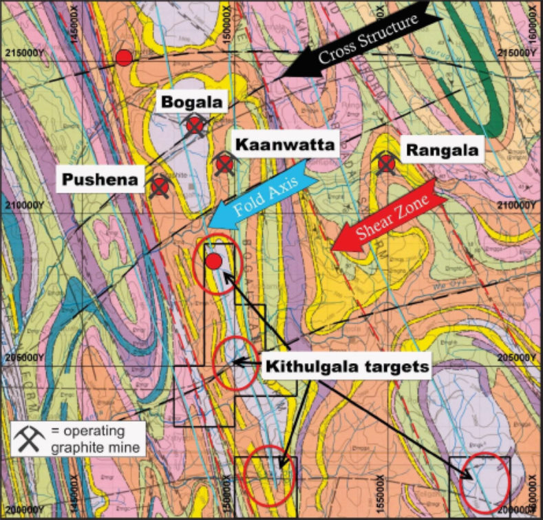
The Kithulgala Project area is underlain by rocks of the Highland and Wanni Complexes including garnet sillimanite biotite gneiss, charnockitic gneiss, hornblende biotite gneiss and quartzite. These rocks form a series of synformal and antiformal structures, with associated regional-scale shear zones trending northwest-southeast towards Bogala. Similar lithstructural positions along strike and within the Kithulaga Project area are yet to be tested by modern exploration techniques.